Article Provided By: John Walker, Contract Support For The NOAA UAS Program Office, and Photos / Figures From John Walker And Robert Moorhead, Director Of Northern Gulf Institute
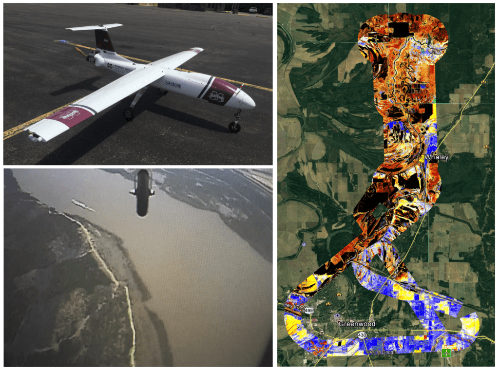
For the second time in two months, NOAA’s Northern Gulf Institute (NGI) and Mississippi State University’s Raspet Flight Research Laboratory successfully executed UAS operations to provide data to the National Weather Service’s (NWS) Lower Mississippi River Forecast Center (LMRFC). With funding provided by the NOAA UAS Program Office, and in response to expressed needs for aerial imagery by the LMRFC following a historic rainfall event, Dr. Robert Moorhead (Director of NGI and principle investigator of the “SHOUT4Rivers” parent project) and his team conducted operations of a large, “Group 3” UAS over vast areas of flooding near Greenwood, MS in February 2019. The primary goal for that first mission was to provide forecasters with critical information to indicate water level heights and show locations of inundation. The data was transmitted in near real-time to the LMFRC office in Slidell, LA to help hydrologists update flood warnings and generate more accurate forecast products for use by emergency managers and the general public. “We were able to see the water as it rose over the course of two days, which helped our office confirm when the crest had been reached,” said Dr. Suzanne Van Cooten, hydrologist-in-charge at the LMRFC.
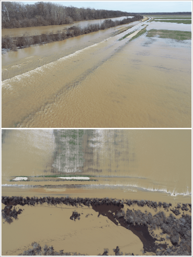
Now following those successful February operations, the crew was recently tasked with yet another important mission to help fulfill more NWS LMRFC data needs. With additional heavy rainfall events from March and April, exasperating flood conditions in several not-yet-fully recovered locations, the team was deployed this time to Greenville, MS, with operations taking place in a critical area along the Mississippi River in late April. As was the case with the previous operation, large swaths of areal imagery were mapped and will be mosaicked together before being sent to NWS forecasters in Slidell to provide them with actual inundation maps that will help them verify and update their models. This type of data contains a wealth of new information, going well beyond that of the individual water gauge point data that these forecasters must typically rely upon.
During this second mission, Dr. Moorhead’s team was also able to achieve a few more accomplishments. In addition to executing operations from an entirely new base location, across the river at the Lake Village Municipal Airport in Arkansas, the crew maintained enhanced situational awareness by streaming and archiving real-time video directly from the platform. Also, with the mission taking place on what was an otherwise typically busy day for manned agricultural aircraft operations in the area, another big milestone demonstrated was the ability to seamlessly integrate the UAS platform into the take off and landing pattern there at an active airport. John Walker, a Cherokee Nation Strategic Programs contractor, supporting the NOAA UAS Program Office, said of the operation, “It was very interesting to observe how all of the local pilots and airport management staff really took to and embraced the operation. There was a steady shuffle of folks walking over throughout the day to check it out and ask insightful questions.” Walker went on to relay one story, following the successful landing of the UAS platform to conclude the day’s operation, “The next pilot circling around in the queue to land in the right-hand traffic pattern jokingly radioed in, ‘Get that mosquito off the runway!’ Of course, it was all in good fun, and it offered just the right amount of levity to wrap up the mission.”
Next up, and with more than a year left in this exploratory project, Dr. Moorhead and his team will continue to work closely with Dr. Van Cooten and others from NWS. With continued support from the NOAA UAS Program, they will identify additional opportunities and explore new approaches for collecting, processing, and disseminating UAS-based aerial imagery to aid forecasters in providing timely, accurate products for the benefit of communities all over the country. Although it is too early conclude anything, it is possible that operations like these may someday soon become yet another useful tool for NWS and other public agencies to aid them in better performing their missions for the general public.