Article and Figures Provided By: Russ Schnell (GML), John Walker (FedWriters/UxS Research Transition Office)
Scientists from NOAA’s Global Monitoring Laboratory (GML) have undertaken novel development of an uncrewed aircraft system (UAS) “hexacopter” that will enable the lab to not only recommence a long-standing mission that was recently forced to halt, but paves the way toward enhanced operations in the future. The composition of Earth’s atmosphere is rapidly changing due to anthropogenic releases of carbon dioxide (CO2) and methane (CH4), which are powerful greenhouse gasses driving global warming. Also, human-made chemicals such as CFC-11 and CFC-12 (refrigerants) are destroying the ozone layer that filters out ultraviolet (UV) radiation. These CFCs and their counterparts destroy enough of the protective stratospheric ozone layer to produce the Antarctic “Ozone Hole”.
Because of the enormous influence these chemicals can have, GML’s mission is to measure and quantify changes over time in the amount of ozone depleting substances and greenhouse gasses in the atmosphere. To accomplish this mission, for decades GML has collected critical atmospheric observations from strategic locations around the globe. One such location is Cape Kumukahi, HI, where scientists have filled flasks with ambient air every week since 1995 for chemical analysis. The long-term data records supplied by these samples are fundamental to understanding changes in atmospheric composition of gases affecting stratospheric ozone, climate, and air quality, and provide an avenue to detect unexpected changes in these chemicals. In fact, NOAA scientists from GML were recently able to use data from the Mauna Loa Observatory and Cape Kumukahi to detect a sudden increase in emissions between 2010 and 2018 of an ozone-destroying chemical, violating the Montreal Protocol, (Montzka et al., 2018), and have precisely located the emissions of the banned chemical to three regions of Asia (Figure 1).
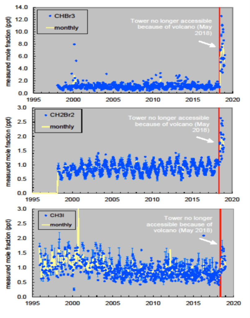
Unfortunately, lava flows from a recent eruption of the Mauna Loa volcano in 2018 destroyed the power line and road, blocking access to a 100-ft. tall tower at Cape Kumukahi, from which the ambient air samples had been collected over that 23-year period and that led to these important, recent findings. Attempts to find a workable new location for the weekly flask sampling were met with limited success, because the alternative sites explored to date have yielded much higher concentrations (from local contamination) of some important trace gases as shown in Figure 1. Without access to the tower, samples can only be collected a few feet above the ground (~ 10 ft. max), thus making the results susceptible to large, near-surface concentration gradients for these gases.
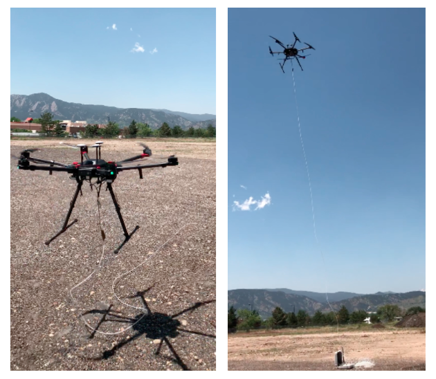
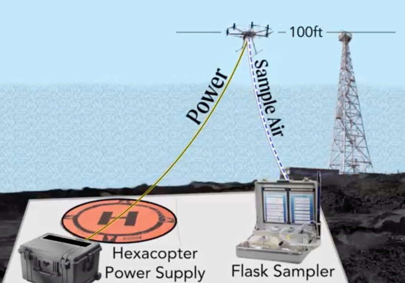
To overcome these issues, GML has developed UAS technology that will, once again, enable weekly flask sampling from a targeted location and altitude, close to the inaccessible Cape Kumukahi tower. This “virtual tower”, consists of a sample line raised by the hexacopter to the height of the original tower. Pumps on the UAS push air samples down and into flasks located on the ground (Figures 2 and 3). The raised line will enable the collection of air from the required altitude with minimal additional complication, expense, and modification of existing equipment.

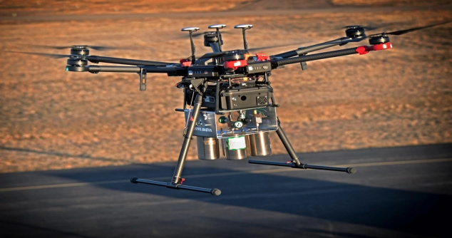
After three years of research and development, the technology has significantly matured and resulted in a completed system (Figure 4). Final demonstration and testing is scheduled to take place during the Spring of 2022. It is anticipated that this virtual tower will supplant those previous operations until such a time when the tower and supporting infrastructure can be repaired. In the meantime, GML is identifying other global locations and designing future operations for which this new capability can be rapidly deployed and sustained to meet this important NOAA mission. The tethered drone air sampling system provides a relatively low-cost (compared to crewed aircraft) method for obtaining measurements from remote locations. It is a compact, easy to use, highly mobile instrument package that is ideally suited for rapid deployment. Such a system could be deployed in the future to pinpoint locations of illicit production of banned chemicals, and for other purposes such as assessing suspected high greenhouse gas effluent sources. Because the UAS can be operated from ships or from land, it could be used around the globe and distributed as needed to understand sources of atmospheric chemicals in a way not previously possible using existing monitoring sites. This innovative technology and corresponding operations has been funded and supported in part by the OAR/Uncrewed Systems Research Transition Office (UxSRTO).