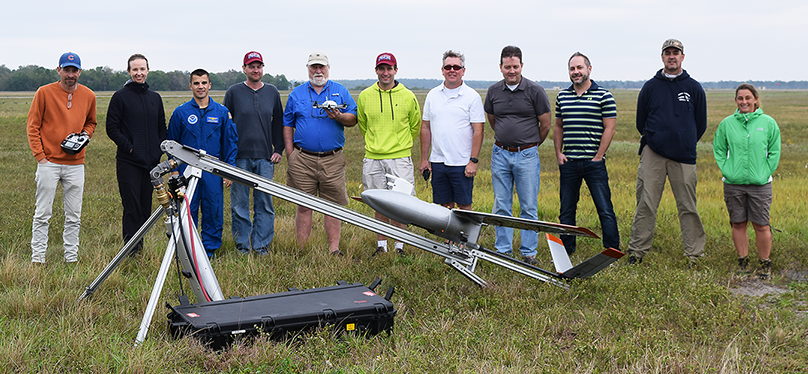
ARTICLE AND FIGURES PROVIDED BY: BRUCE BAKER
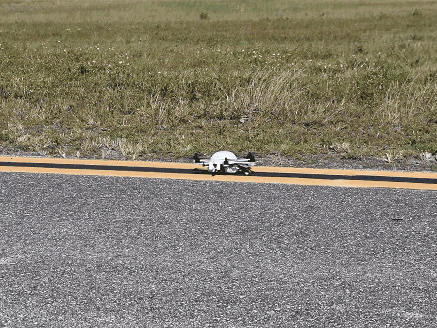
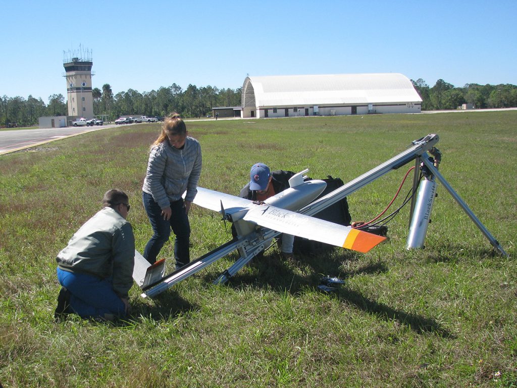
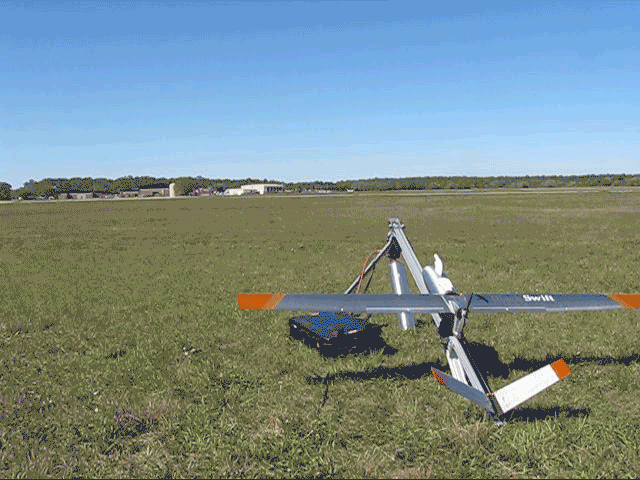
On March 4-6, a team of nine NOAA scientists and engineers gathered at Avon Park, a U.S. Air Force (USAF) test range north of Sebring, Florida, to conduct first-of-a-kind tests on two small unmanned aircraft systems (sUAS). The team consisted of personnel from the Atmospheric Turbulence and Diffusion Division (ATDD) of NOAA’s Air Resources Laboratory, NOAA’s Unmanned Aircraft Systems Program Office (UASPO), and NOAA’s Office of Marine and Aviation Operations (OMAO) Aircraft Operations Center (AOC). The two sUASs being tested were recently acquired by ATDD. They are a Meteomatics Meteodrone Severe Storms Edition (SSE), which performs vertical takeoffs and landings, and a BlackSwift Technologies S2 fixed-wing aircraft similar in design to an airplane.
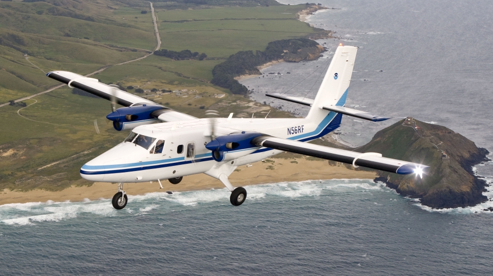
The tests were very successful. Over the three-day testing period, the team performed over a dozen flights with the Meteodrone and six flights with the S2. The Meteodrone was flown up to a maximum altitude of 950 m above ground level (AGL), whereas the S2 reached 1200 m AGL during one of its flights. A ground-based radar system, integrated with geospatial software, was deployed in an attempt to determine its capability to mitigate potential threats to these sUAS(s) by targets within the airspace (e.g., traditional airplanes, other sUAS(s), hot air balloons, birds, etc.). During all tests, the ground-based radar system detected both the Meteodrone and S2, as well as other air traffic in the area. To further evaluate the ground-based radar system, on 5 March a NOAA Twin Otter aircraft performed multiple flyovers of the site, and the ground-based radar system detected this aircraft as well. Additionally, Meteodrone data were used to generate analyses of temperature, moisture, and wind fields in near real-time using the Meteomatics software package.
Since Avon Park is a USAF bombing range which NOAA AOC has utilized to test both full-size and drone systems in the past, its airspace is not subject to the same Federal Aviation Administration (FAA) restrictions imposed on the national airspace system. The relaxed limitations enabled the team to fly both aircraft to their respective maximum flight altitudes. Knowing each aircraft’s upper limit and the point at which the operator would lose visual line of sight were key to performing safer, higher flights in the future. Essentially, this exercise enabled the team to measure the same kind of parameters used by air traffic controllers.
Taking measurements of temperature, relative humidity, wind speed and pressure (collectively known as vertical profiles) with a copter and fixed-wing aircraft at such a high altitude hasn’t been done before, so scientists were unsure what to expect. Historical data is sparse, so there has always been a large gap in knowing what is happening with the thermodynamics and kinematics of the atmosphere (e.g. the transformations responsible for weather and climate). Flying the sUAS(s) to higher altitudes enables scientists to design increasingly useful experiments to study the boundary layer – the lowest few kilometers of the atmosphere where we live, where weather occurs, and where ARL focuses its research.
NOAA’s AOC and UASPO are working to obtain Certificates of Authorization (COA) from the FAA to fly up to 10,000 ft. Once COAs are obtained, both of ATDD’s sUAS(s) will be used for vertical profile sampling within the lowest few kilometers of the atmosphere. Higher altitude, more frequent measurements will greatly enhance operational weather forecasting by the National Weather Service (NWS) through analysis of the observations, and inclusion of the data into numerical weather prediction models. These data will also help refine future field intensive studies of the boundary layer. The test at Avon Park paves the way toward eventually having autonomous vertical profiles occurring any time of the day in different locations around the U.S. Currently, there are only about 100 National Weather Service weather forecast offices in the U.S. that perform vertical profiling. They all utilize weather balloons for this twice-daily analysis. ATDD plans to start working with its closest forecast office, in Morristown, Tennessee, to determine how more frequent, more localized vertical profiles help improve forecasting. ATDD is also continuing to assess new technologies and instrumentation capable of utilization by sUAS(s).