

ARTICLE PROVIDED BY JOHN WALKER [(3) UASPO]
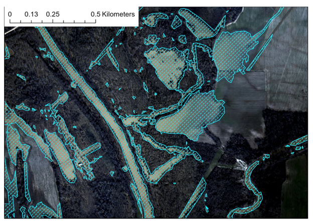
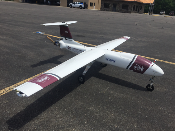
With funding provided by the NOAA UAS Program Office in OAR through the “SHOUT4Rivers” project, Dr. Robert Moorhead (Director of NOAA’s Northern Gulf Institute, NGI, and principal investigator) and his team have been working for the past couple of years to develop and test plans to deploy large UAS to collect aerial imagery of flood-impacted regions (Figure 1) in response to needs expressed by multiple NWS River Forecast Centers (RFCs). Leveraging the experience and resources available through Mississippi State University, home to NGI, this team achieved a milestone in February 2019 when it first deployed its large UAS (Griffon Outlaw G2E; Figure 2) for operations over vast areas of flooding near Greenwood, MS. Aerial imagery of flooded lands was transmitted in near real-time to the NWS Lower Mississippi RFC office in Slidell, LA to help hydrologists update flood warnings and generate more accurate forecast products for use by emergency managers and the general public.
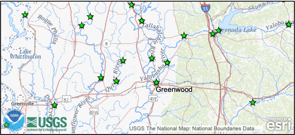
While the primary goal of this mission was to provide forecasters with critical situational awareness information, used to immediately enhance the effectiveness of their operational products and public communication, a secondary (yet also critical) goal was to generate the high-resolution data necessary for providing impactful updates to hydrologic models. Imagine a map of water level gauges, sparsely placed in strategic locations across a vast network of rivers, streams, and tributaries (Figure 3). Each one provides a single number, updated throughout the course of each day, representing the water level height at a particular point location. Based on this sporadic point data, the hydrologic (i.e., “flood forecast”) models predict the potential impacts of nearby flooding events. These impacts are determined from what is known about those water levels, combined with other information pertaining to the surrounding landscape and the amount of space available that could hold water. However, soil erodes, landscapes change, and river channels evolve through time. Without updated information about these changes across broad basin areas, such as that provided by airborne imagery, what the hydrologic models may have correctly predicted a couple of years ago may soon be incorrect, even with accurate input on water levels from the gauges. Additionally, these errors can be compounded due to the lack of gauge information for back channels and other parts of the river system that cannot practically be characterized by the current gauge network.
This is the important type of work that scientists and engineers at NGI and Mississippi State University have been working on with NOAA and recently published in the peer-reviewed journal, “Remote Sensing“. For more information about this research, and to read the full article, access the following link: https://doi.org/10.3390/rs12101549.
Credits
1 Department of Geosciences, Mississippi State University, Mississippi State, MS 39762
2 Northern Gulf Institute, Mississippi State University, Starkville, MS 39759, USA
3 Cherokee Nation Strategic Programs supporting: NOAA OAR UAS Program Office
Reference:
Dyer, J.L.; Moorhead, R.J.; Hathcock, L. Identification and Analysis of Microscale Hydrologic Flood Impacts Using Unmanned Aerial Systems. Remote Sens. 2020, 12, 1549.
Related online content: