
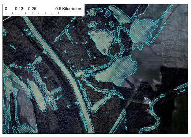
NGI Publishes Research on Use of UAS to Identify and Analyze Flood Impacts
With funding provided by the NOAA UAS Program Office in OAR through the “SHOUT4Rivers” project, Dr. Robert Moorhead (Director of NOAA’s Northern Gulf Institute, NGI, and principal investigator) and his team have been working for the past couple of years to develop and test plans to deploy large UAS to collect aerial imagery of flood-impacted regions in response to needs expressed by multiple NWS River Forecast Centers (RFCs).
NGI Publishes Research on Use of UAS to Identify and Analyze Flood Impacts Read More »