Article and Figures Provided By: G. Curtis Roegner (NMFS)
Juvenile Pacific salmon rely on functioning wetlands for food and shelter as they migrate to the sea. In the Pacific Northwest, most wetland habitats have been lost or severely impacted, necessitating widespread restoration programs enacted to improve connectivity between water systems and reestablish native vegetation. Programs may include varied ecological engineering solutions, but all require monitoring to assess effectiveness. Until recently, assessments have lacked spatial and temporal resolution and have been time-consuming and expensive.
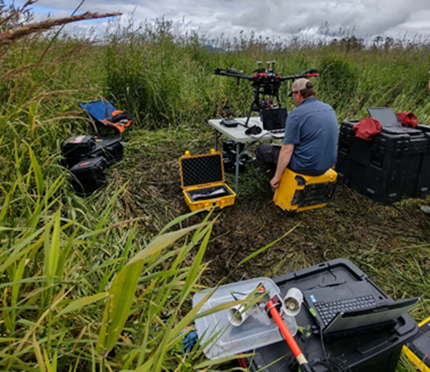
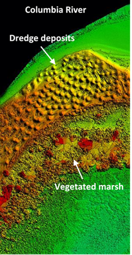
With funding and logistical support from the NOAA Oceanic and Atmospheric Research (OAR) Uncrewed Systems Research Transition Office (USRTO), scientists from the National Marine Fisheries Service (NMFS) have developed integrated remote sensing protocols using Uncrewed Aerial Vehicles (drones), advanced instrumentation, and image analysis methods that together facilitate a broad habitat assessment capability. Vehicle payloads include high resolution visible (RGB) cameras, LiDAR to measure topography, and imaging spectrometry for remote object identification (Figure 1). The spectrometer records the characteristic “spectral signature” of an object, such as a specific vegetation species or sediment type (a “photonic fingerprint”). The unique signatures are determined through ground-truth (direct observations) calibration surveys that are then collated into a “spectral library”. Once a robust spectral library is assembled, further on-ground field collections are not required. Through machine learning, the library is accessible by computer algorithms allowing the automated categorization of imagery and to produce maps and extract statistics of interest. Instrumented drone surveys thus enable the rapid and comprehensive measurement of habitat metrics at far higher resolution than previously possible (Figure 2).

There are numerous applications for the NMFS methodology. Foremost for salmon is the capability of rapid habitat surveys at new sites without the need for ground-truthing, due to expanding and disseminating the regional spectral library. For restoration studies, repeated sampling over months to years will reveal critical changes in landforms and vegetation that define progress of restoration actions. These assessments provide for adaptive management actions if restoration trajectories deviate from expected goals. One pertinent example for many restoration projects is the early identification and eradication of invasive species before their large-scale establishment.
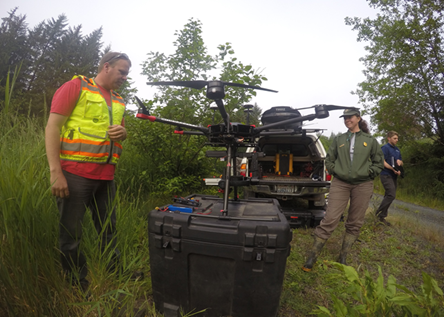
Further, the methodology is adaptable, for example toward a new class of restoration actions involving construction of intertidal substrate using dredge spoils, for which the instrument suite would be ideally applicable (Figure 3). Other regional remote sensing projects with management concerns include mapping seagrasses, evaluating species interactions at oyster culture sites, creating censuses of salmon-eating pinnipeds and birds, and targeting water quality issues such as thermal stress and harmful algal blooms. Future studies such as these may require a different suite of instruments (e.g. thermal imagery), which are easily adaptable into this methodology. The emerging capacity to conduct very high resolution, largely automated (“on-demand”), and rapid habitat assessments will greatly improve scientists’ ability to understand and address pressing management issues.
This project is a partnership between NOAA Fisheries (G. Curtis Roegner), Pacific Northwest National Laboratories (Andre Coleman & Amy Borde), RykaUAS (Joe Aga & George Pierce), and the National Park Service (Carla Cole). The UAS used for remote sensing of intertidal habitat types includes a 110-band imaging spectrometer (BaySpec OCI) and LiDAR (Phoenix miniRanger System with Sony A7R 42MP camera) flown on a DJI Matrice 600 hexacopter (Figure 4 – Video)