
Article and Figures Provided By: Bianca Baier (GMD)
Duration: 24 months (05/23/19 – 05/23/21)
Principal Investigators: Colm Sweeney, Bianca Baier
U.S. Department of Commerce
National Oceanic and Atmospheric Administration
Global Monitoring Division
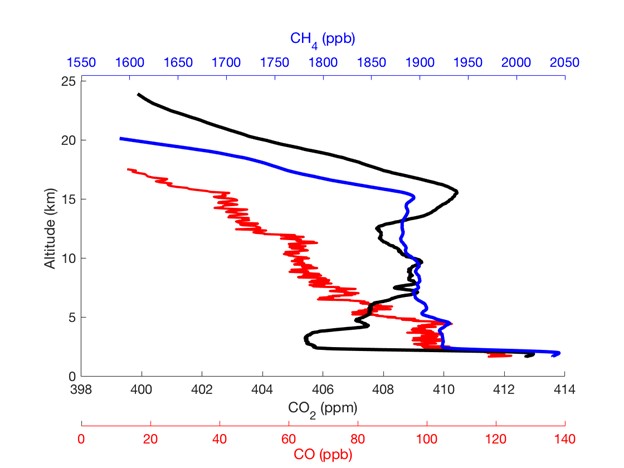
The Global Monitoring Division (GMD) of NOAA’s Earth System Resource Laboratory (ESRL) has revolutionized high-altitude trace gas sampling with the AirCore balloon-borne sampler. Having collected over 120 greenhouse and trace gas profiles of carbon dioxide (CO2), methane (CH4), and carbon monoxide (CO), the AirCore has proven to be an effective, low-cost method for sampling over 98% of the atmosphere (Figure 1 and additional information at following AirCore link). Over the past decade, the AirCore has become a critical aspect of carbon cycle model evaluation as well as validation of satellite greenhouse gas retrievals.
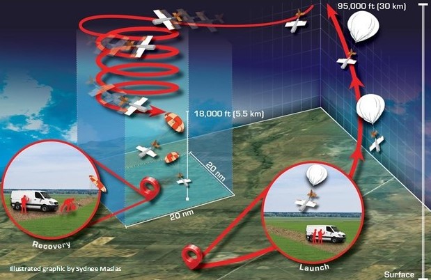
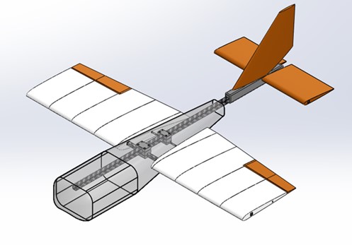
AirCores are routinely launched near Boulder, Colorado using a 6.6-pound balloon with a parachute-based recovery. However, similar to routine weather balloon launches, the recovery of the AirCore and accompanying scientific instrumentation is not always easy. AirCore recovery sites can be nearly 80 kilometers (50 miles) away from the launch site. Recovery sites depend on local winds and are limited to vehicle-accessible locations with few trees, lakes, and housing or commercial development. To increase options for AirCore sampling locations, NOAA/GMD is teaming up with UAS designers at Arizona State University and developers at Delta Zee Solutions, LLC to construct the “High-altitude Operational Return Unmanned System” (HORUS) (Figure 2).
The AirCore-glider system also uses a balloon-based ascent, but upon descent will change over to an autopilot system to return to a pre-determined recovery area (Figure 3). HORUS will significantly improve AirCore recoverability in various locations. In addition, because weather balloons are not always recoverable, their in situ meteorological instrumentation is limited in cost and quality. HORUS enhances our ability to deploy and recover higher-quality sensors (i.e. temperature, water vapor, aerosols, etc.) to better evaluate models and satellites.
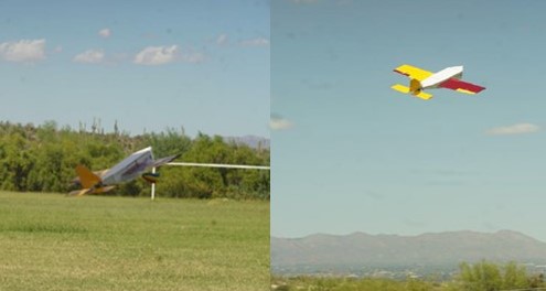
A half-scale version of the HORUS was recently constructed and tested in Tempe, AZ for design verification and flight characteristics (Figure 4). Development of the full-scale version will begin after this half-scale testing is completed. This project is funded by the NOAA UAS Program Office and includes a partnership between NOAA ESRL/GMD and Arizona State University.
