
Principal Investigator: Dr. Colm Sweeney and Co-Principal Investigator: Dr. Bianca Baier (GML)
The NOAA Global Monitoring Laboratory (GML) AirCore has revolutionized high-altitude trace gas sampling to ~30 km (> 98% of atmosphere) in the past decade. These trace gas profiles provide valuable information for satellite validation and understanding of atmospheric composition in the lower-middle stratosphere that are unreachable by most aircraft. The AirCore — a 100-m long coiled tube — is a passive whole-air sampling system that was developed at NOAA/GML for balloons. As the balloon ascends, the AirCore passively empties the gas inside this tubing to equilibrate with the atmospheric pressure. After the balloon is cut away and the AirCore starts to descend, the AirCore passively fills to collect a continuous sample of air from the stratosphere to the ground. GML then collects the AirCore measurements and analyze the air sample in the laboratory for greenhouse gases.To enable better sampling at high-altitudes GML, along with collaborators, began a balloon-glider system project in May 2019 under funding and project support provided by NOAA’s Uncrewed Systems Research Transition Office (UxSRTO) and the NOAA Uncrewed Systems Operations Center (UxSOC).
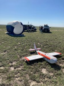
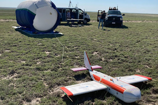
Developed by scientists from NOAA and CIRES, along with collaborators at Arizona State University, Delta Zee Solutions, Spektreworks, and the University of Colorado’s Integrated Remote and In Situ Sensing (IRISS), HORUS is a low-tech, cost-effective balloon-glider system for hosting a small payload of specialized atmospheric instruments to the edge of space, and then guiding it back to its launch location.
On May 17, 2023, a break in the spring rains over the Pawnee Grasslands in northeastern Colorado provided a small window for GML to complete a four year effort to deploy a balloon-borne atmospheric sampling and measurement system. The final step in this long term project included the deployment of a weather balloon to an altitude of 90,000 feet in controlled airspace and then the return of the system to the launch location two and a half hours later.
The success of this milestone is a major achievement for weather and climate research, which depends on balloon-borne measurements. The use of balloons has been limited due to their tendency to drift with the wind and often land 100 miles away from the launch point. While balloons can reach altitudes far above those of aircraft, which typically fly at less than 45,000 feet, the lack of control that is needed to bring instruments back to a planned location often dictates the type of instruments that are deployed on a balloon. These flights represent a unique coordination between NOAA and the Federal Aviation Administration (FAA) to obtain the approvals to allow unmanned aerial vehicles (UAVs) fly beyond the visual line of sight at altitudes greater than 2,500 feet above the ground.
The ultimate goal of this project is to deploy the High-altitude Operational Return Uncrewed System glider, which has been nicknamed HORUS after the falcon-headed Egyptian god, in many different locations where traditional balloon retrieval would be impossible to meet mission needs. The project also aims to have this balloon-glider system launched from ships to provide a window into the upper atmosphere all over the world.