Article and Figures Provided By: Colm Sweeney and Bianca Baier
Principal Investigator: Colm Sweeney
Co-Investigator: Bianca Baier
Office of Oceanic and Atmospheric Research (OAR)/Global Monitoring Laboratory (GML)
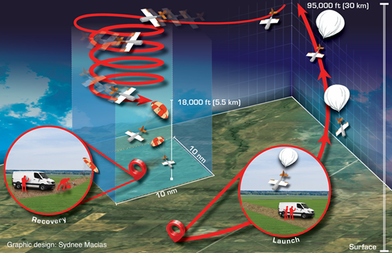
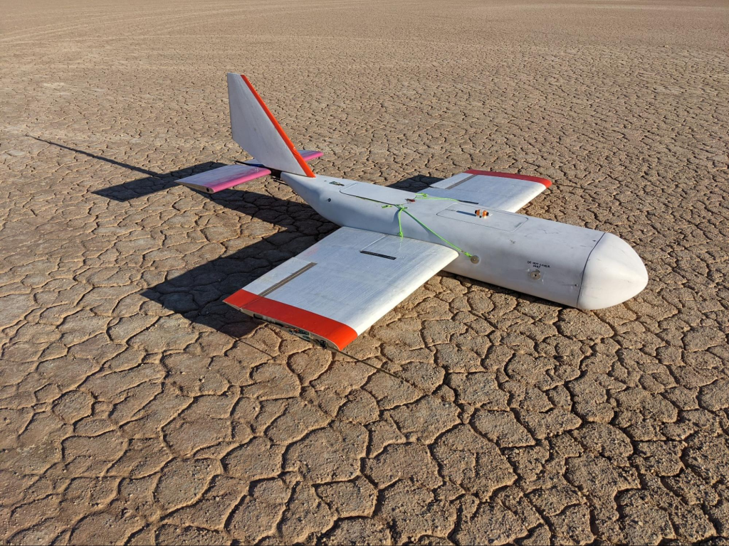
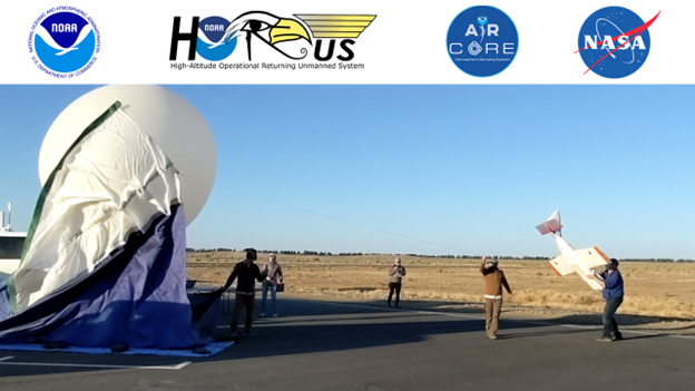
Scientists from NOAA’s Global Monitoring Laboratory (GML) and the Cooperative Institute for Research in Environmental Sciences (CIRES) successfully tested new technology for high-altitude air sampling and instrument recovery from May 13-25, 2021 (Figure 1). This project funded by NOAA/OMAO Uncrewed Systems Operation Center (UxSOC); and supported by the NOAA/OAR Uncrewed Systems Research Transition Office (UxSRTO), engaged in a field campaign at the NASA Armstrong Flight Research Center and Edwards Air Force Base, California testing the High-altitude Operational Return Unmanned System (HORUS). The HORUS, named after the ancient Egyptian god, translating to “he who is above”, is a custom-developed, 6-foot wingspan, portable, fixed-wing glider. The HORUS glider is the first of its kind that is uniquely capable of returning a high-capacity scientific payload of ~10 lbs including the AirCore and other accompanying scientific instruments from the stratosphere (Figure 2).
Similar to an ice core, which captures air exposed to ice buried deep in glaciers of Greenland and Antarctica, the AirCore atmospheric sampling system collects a “core” of air vertically through the atmosphere. The collected air samples can be measured post-flight for greenhouse gases such as carbon dioxide, methane and nitrous oxide.
During flight testing in May, high-altitude balloons carried the device inside of the HORUS airframe into the upper atmosphere, reaching an altitude of 75,000 feet above the mean sea level (MSL), where the balloon released the HORUS payload. Shortly after release, the AirCore began to collect air samples from between an altitude of 72,000 feet MSL and the designated landing spot at the ground (Figure 3).
During its descent, the HORUS auto piloted the instrumentation to a predetermined landing site via an onboard computer. Reaching speeds of more than 200 knots over the ground at the beginning of the glide phase, the HORUS was able to make up for the downwind drift caused by the more than 60-knot winds it had encountered earlier at 40,000 feet MSL during the balloon ascent. Thus, HORUS is capable of bringing a high-volume scientific payload from well over 75,000 feet MSL back to a location close to its initial launch site.
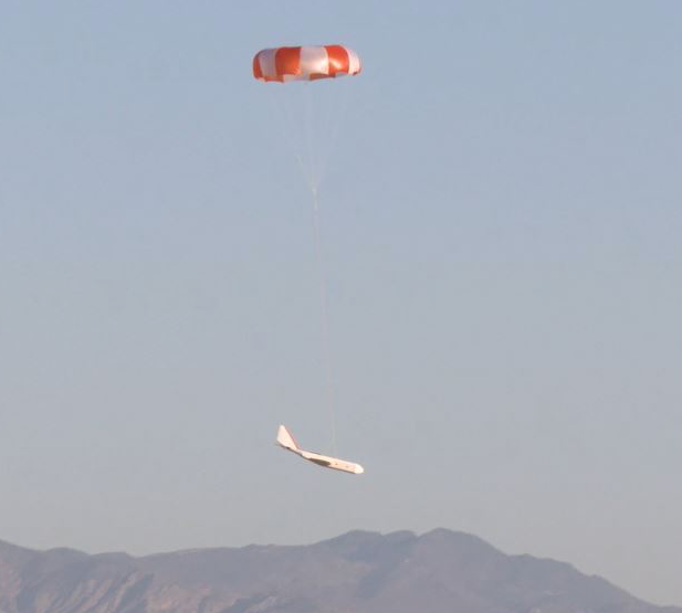
For this test, a parachute was deployed at 1,000 feet above ground level (AGL), slowing descent of the platform and scientific instrumentation and enabling a soft landing. The Federal Aviation Administration (FAA) currently imposes a “see and avoid” requirement for uncrewed aerial systems (UAS) between 400 feet and 18,000 feet MSL because small aircraft flying within this altitude range often lack the ability to detect the location and ID beacons that planes flying above 18,000 feet are required to carry. However, balloons and parachutes are waived from the need to “see and avoid” below 18,000 feet MSL. With the proven parachute deployment capability, the FAA has indicated that users do not need to acquire a waiver to “see and avoid” other aircraft as long as HORUS is under parachute below 18,000 feet MSL.
Beyond this initial high-altitude test, it is anticipated that the HORUS can meet FAA requirements with an auto-piloted glide to a predetermined location before it descends to 18,000 feet MSL and then drift under parachute to its final landing spot. This flight method can save a significant amount of time for the launch crew to safely recover the science package and vastly increase the number of likely places from which scientists can collect data.
The success of this field campaign brings the OMAO UxSOC funded and NOAA UxSRTO supported HORUS to a Readiness Level of 8 out of a possible 9 (NAO 216-105B: Policy On Research and Development Transitions), indicating that it has been successfully demonstrated in the same environment required for routine operational deployments. It marks an exciting opportunity for many of NOAA’s atmospheric research stakeholders because it allows high-value, balloon-borne sensor packages to be deployed and retrieved from the same location.
With HORUS, scientists can efficiently collect critical, high-accuracy and high-precision data from all over the world to help improve weather and climate models, which have been limited until now because of the inability to effectively retrieve and reuse valuable sensor packages in areas where conditions and a lack of such technology have prohibited the realization of this novel concept. Furthermore, this new model of operating reusable balloon-borne packages opens up many other commercial opportunities beyond the realms of academia and government research.