The OAR ORTA UxSRTO is no longer operating.
For further information, please visit The Office of Marine and Aviation Operations (OMAO) Uncrewed Systems Program webpage.
UxSRTO News
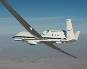
NOAA’S Sensing Hazards with Operational Unmanned Technology (SHOUT) Experiment: Observations and Forecast Impacts
During 2015 and 2016, NOAA conducted three field campaigns using the NASA Global Hawk autonomous aircraft outfitted with GPS dropwindsondes and remote sensors. The Sensing Hazards with Operational Unmanned Technology (SHOUT) project evaluated the potential ability of this high-altitude aircraft to collect novel observations to improve forecasts of high-impact weather events including hurricanes. The experiment also examined the effectiveness of employing new technology of this type. A new article to be published in the Bulletin of the American Meteorological Society, led by ESRL PSD with multiple NOAA and joint institute co-authors, provides a an overview of SHOUT and summarize the various missions flown over the two-year campaign, the observations collected and their application, and the results of a diverse set of studies evaluating the impact of the data on multiple operational forecast systems.
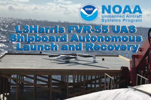

L3Harris Successfully Completes Autonomous Shipboard Launch and Recovery of FVR-55 Unmanned Aircraft
On February 17, 2020, flight tests were conducted by L3Harris on the M/V Richard L. Becker off Fort Lauderdale, FL to demonstrate autonomous takeoff and recovery from a moving vessel at-sea. L3Harris completed all objectives and demonstrated fully autonomous flight using Hybrid Quadrotor (HQ) technology from a moving ship with limited deck space. The FVR-55 took off from the ship vertically, switched to fixed wing flight, and returned and landed vertically on the ship autonomously (no external pilot control inputs required).
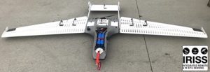

Deployment and Operation of the RAAVEN small Unmanned Aerial System (sUAS) in Support of NOAA Science during ATOMIC
Supported with UAS Program Office funding, a team from the University of Colorado Boulder will deploy the RAAVEN sUAS from Barbados between 19 January and 17 February 2020. Launch and retrieval will occur from the shore at a field and the adjacent beach in Morgan Lewis, Barbados. RAAVEN miniFlux measurements can directly contribute to advancing our scientific understanding relevant to NOAA forecasting efforts across weather and climate scales. Specifically, information on the vertical distribution of
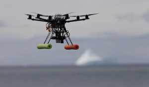

Surveying Antarctic Predators to Inform Fisheries Management
NOAA Fisheries’ Antarctic Ecosystem Research Division (AERD) studies and monitors several species of seals and penguins that are indicators of the health of the regional fishery for Antarctic krill. Krill are the focus of an expanding international fishery in the Antarctic, but are also a fundamental food source for the region’s fish, marine mammals, and birds. Accurate census counts and measurements of body condition are fundamental to seal and penguin population management, but can be difficult to obtain in remote polar environments. Funding from the UAS Program Office partially supports said studies.
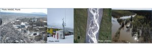

Building an Operational Program for Small UAS for Flood Mapping and Routine Equipment Inspection at NWS Alaska
In Alaska, flooding is the most frequent cause of state disaster declarations. Ice jam floods during spring break-up have devastated many communities along waterways in the large Yukon and Kuskokwim River basins over the past century. Snowmelt and heavy precipitation can cause flooding in the spring and summer time. Alaska also faces frequent impacts from the outbursts of glacially dammed lakes. For many years, the Alaska-Pacific River Forecast Center (APRFC) has depended on partners to help monitor flood conditions in remote communities on the ground or in small aircraft. Building in-house capabilities to deploy small Unmanned Aerial Systems, helps bring cutting edge data collection to the decision-support services at the National Weather Service.
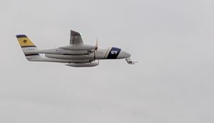

Observing Atmospheric Fluxes with UAS (miniFlux)
Understanding the transfer of heat and momentum between different layers of the atmosphere and the underlying surface is critical for improving our weather and climate forecasts. Scientists at NOAA’s Physical Sciences Division (PSD) and the University of Colorado’s (CU) Cooperative Institute for Research in Environmental Sciences (CIRES) are working to develop, test, calibrate and deploy the compact, lightweight (1.2 lbs) miniFlux sensor system (Figure 1). This miniaturized instrument, which is supported by NOAA’s UAS Program Office, can reliably collect these measurements from unmanned aircraft systems (UAS). Deploying this lightweight package on UAS over difficult-to-sample regions of the Earth can provide perspectives on these important processes in ways not previously possible.
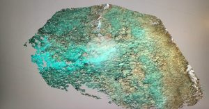

sUAS Bathymetric Mapping for Featureless Bottom Topography Using Naturally Occurring Structure Light
Unmanned aircraft systems (UAS) with Flash Structure from Motion (SfM) capabilities are of great interest as a supplement to existing technologies for marine debris detection, reef restoration, and ship-grounding impacts. Coastal storms and geo-hazards, including hurricanes, nor’easters and tsunamis, can deposit marine debris over vast areas, threatening marine ecosystems and navigation safety. Identification and geolocation of the debris is necessary to direct removal efforts, but can be a challenging and expensive task. These events can also cause significant damage to coral reef communities and even dislodge corals. Restoration triage to “replant” the damaged corals is time critical. Additionally, ship-grounding incidents caused by coastal storms require accurate and rapid information to conduct damage assessment and recovery efforts. The available geospatial information collected after Hurricanes Maria and Irma, which heavily impacted the U.S. Caribbean and beyond, clearly indicate the limitations of current coastal intelligence abilities to addressing disaster impacts in the littoral zone.
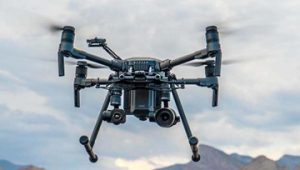

Developing DJI M210RTK Shipboard Operations
The NOAA Remote Sensing Division (RSD) and Hydrographic Services Division (HSD) successfully completed Phase One of a UAS Program Office-funded project to develop the capability and approved documented operating procedures to safely launch and recover an M210RTK UAS from NOAA ships and small boats manually.
The establishment of a fully operational M210RTK system, trained UAS and vessel operators, operations protocols, data management and integration strategy, will allow unmanned rotary wing aerial assets to acquire data supporting NGS roadmap and OCS strategic goals that align with elements of the NOS Program, Line Office and Agency strategic plans. This project furthers the NOS “Safe and Efficient Transportation and Commerce” Priority by exploring and optimizing the use emerging airborne technology for coastal mapping and obstruction investigation surveys and the “Preparedness and Risk Reduction” Priority by investigating the use of UAS as a tool for rapid deployment damage assessment imagery.
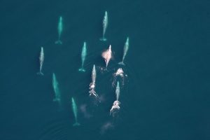

Marine Mammal Monitoring Surveys Using a Hybrid Fixed-Wing UAS
Gathering data on the size of marine wildlife populations and better understanding the risks human activities pose to these populations are core responsibilities of NOAA Southwest Fisheries Science Center / Marine Mammal and Turtle Division. In this study, supported by the UAS Program Office, scientists will be evaluating the use of a fixed-wing UAS platform with vertical take-off and landing (VTOL; Firefly6 Pro, BirdsEyeView Aerobotics, Inc.).
