
UAS Characterization of High Wind Damage to Vegetation and Rural Area Assessments
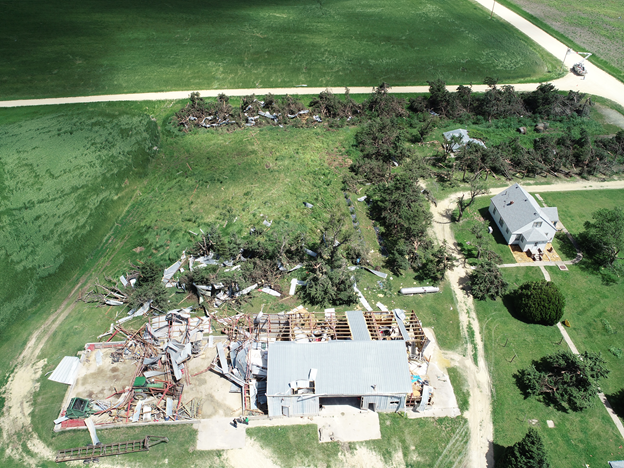
Damage assessments provide insight into the occurrence, intensity, and distribution of tornadoes and other high-wind events. Current ground survey and satellite assessments, however, are restricted by available resources (e.g., personnel, time, and cost), accessibility, technological limitations, and damage indicators used to infer storm intensity. These assessments can be especially challenging in rural areas because storm damage is frequently underestimated due to the inability to detect vegetation stress, limited vegetation damage indicators, and low population density. In these sparsely populated areas, storm damage is often underreported and consequently affects severe storm climatology and our understanding of risk. Underestimating this risk can have serious implications on hazard monitoring as well as disaster preparedness and recovery in rural areas. With the help of the NOAA Oceanic and Atmospheric Research (OAR) Uncrewed Systems Research Transition Office (USRTO), scientists from the NOAA National Severe Storms Laboratory in collaboration with the Cooperative Institute for Mesoscale Meteorological Studies are working on developing an uncrewed aircraft system (UAS)-based approach to better characterize high-wind damage to vegetation and in rural areas to improve disaster response and recovery.
UAS Characterization of High Wind Damage to Vegetation and Rural Area Assessments Read More »