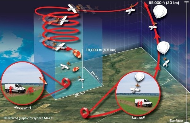
First Test Flights of the High-altitude Operational Return Unmanned System (HORUS) for AirCore
AirCores are routinely launched near Boulder, Colorado using a 6.6-pound balloon with a parachute-based recovery. However, similar to routine weather balloon launches, the recovery of the AirCore and accompanying scientific instrumentation is not always easy. AirCore recovery sites can be nearly 80 kilometers (50 miles) away from the launch site. Recovery sites depend on local winds and are limited to vehicle-accessible locations with few trees, lakes, and housing or commercial development. To increase options for AirCore sampling locations, NOAA/GMD is teaming up with UAS designers at Arizona State University and developers at Delta Zee Solutions, LLC to construct the “High-altitude Operational Return Unmanned System” (HORUS).