Official websites use .gov
A .gov website belongs to an official government organization in the United States.

Secure .gov websites use HTTPS
A lock ( ) or https:// means you’ve safely connected to the .gov website. Share sensitive information only on official, secure websites.

Ken Vierra

National Severe Storms Laboratory High-Wind Damage Assessment Following Severe Weather Events

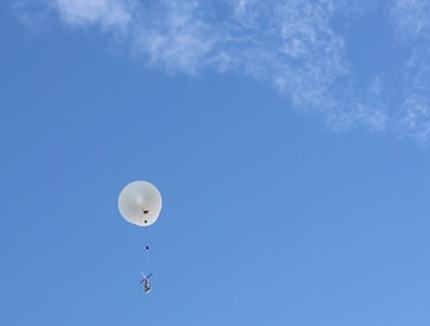
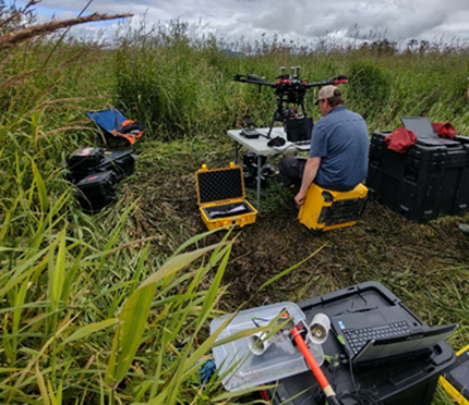
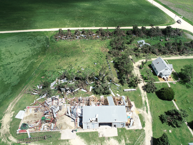
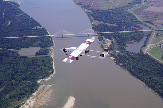
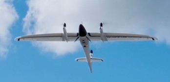
National Severe Storms Laboratory (NSSL) / Cooperative Institute for Mesoscale Meteorological Studies (CIMMS) will document high-wind damage immediately following high-wind events in the Southeast US from February 15th to April 30th, 2021. UAS platforms will be deployed to collect high-resolution imagery of storm damage affected areas:

1) To better characterize high-wind damage to vegetation and in rural areas.

2) To better link signatures from remote sensing platforms (radars and satellites) to impacts at the ground to improve understanding of severe storm-level dynamics.

To learn more about NSSL UAS operations and objectives refer to the flowing link: https://inside.nssl.noaa.gov/uas/

Disclosure: The proposed UAS operations would not involve any intentional collection of Personally Identifiable Information (PII). Any accidental or “inadvertent” PII collection would be obscured or deleted through irreversible pixel blurring, pixel blocking using overlaid shapes/symbols, and permanent cropping. For more information on Privacy refer to the following: Privacy Act of 1974 – 5 USC 552a. Additionally, NSSL/CIMMS would not intentionally fly over individuals. Although consent may not be obtained, there is minimal impact to individuals because NSSL/CIMMS would not retain any PII through the obscuration methods detailed above.

National Severe Storms Laboratory High-Wind Damage Assessment Following Severe Weather Events Read More »

NOAA’s Global Monitoring Laboratory Gears up for Testing of High-Altitude sUAS and Full Scientific Payload at NASA’s Armstrong Flight Research Center and Edwards Air Force Base

NOAA’s Global Monitoring Laboratory (GML) has transformed high-altitude greenhouse gas sampling in the past decade with the AirCore balloon-borne sampler that collects air from the stratosphere (~95,000 ft Mean Sea Level (MSL) to the earth’s surface, analogous to an ice “core.”  A typical AirCore flight is facilitated by a balloon-based ascent to 95,000 ft MSL, followed by balloon cutaway and parachute recovery to the ground. Because the AirCore and its accompanying scientific payload – facilitated by small balloon technology – enables atmospheric sampling at altitudes higher than most aircraft measurement systems, this novel technique is an effective method for sampling trace gases such as carbon dioxide, methane, carbon monoxide and other meteorological state variables (temperature, relative humidity, pressure) in more than 98 percent of the earth’s atmosphere at a fraction of the cost of aircraft systems.

NOAA’s Global Monitoring Laboratory Gears up for Testing of High-Altitude sUAS and Full Scientific Payload at NASA’s Armstrong Flight Research Center and Edwards Air Force Base Read More »

Advances in Monitoring Restoration of Juvenile Salmon Habitat with Drones

Juvenile Pacific salmon rely on functioning wetlands for food and shelter as they migrate to the sea. In the Pacific Northwest, most wetland habitats have been lost or severely impacted, necessitating widespread restoration programs enacted to improve connectivity between water systems and reestablish native vegetation. Programs may include varied ecological engineering solutions, but all require monitoring to assess effectiveness. Until recently, assessments have lacked spatial and temporal resolution and have been time-consuming and expensive. 


With funding and logistical support from the NOAA Oceanic and Atmospheric Research (OAR) Uncrewed Systems Research Transition Office (USRTO), scientists from the National Marine Fisheries Service (NMFS) have developed integrated remote sensing protocols using Uncrewed Aerial Vehicles (drones), advanced instrumentation, and image analysis methods that together facilitate a broad habitat assessment capability. 

Advances in Monitoring Restoration of Juvenile Salmon Habitat with Drones Read More »

UAS Characterization of High Wind Damage to Vegetation and Rural Area Assessments

Damage assessments provide insight into the occurrence, intensity, and distribution of tornadoes and other high-wind events. Current ground survey and satellite assessments, however, are restricted by available resources (e.g., personnel, time, and cost), accessibility, technological limitations, and damage indicators used to infer storm intensity. These assessments can be especially challenging in rural areas because storm damage is frequently underestimated due to the inability to detect vegetation stress, limited vegetation damage indicators, and low population density. In these sparsely populated areas, storm damage is often underreported and consequently affects severe storm climatology and our understanding of risk. Underestimating this risk can have serious implications on hazard monitoring as well as disaster preparedness and recovery in rural areas. With the help of the NOAA Oceanic and Atmospheric Research (OAR) Uncrewed Systems Research Transition Office (USRTO), scientists from the NOAA National Severe Storms Laboratory in collaboration with the Cooperative Institute for Mesoscale Meteorological Studies are working on developing an uncrewed aircraft system (UAS)-based approach to better characterize high-wind damage to vegetation and in rural areas to improve disaster response and recovery.

UAS Characterization of High Wind Damage to Vegetation and Rural Area Assessments Read More »

UAS Missions Supporting Flood Forecasting Following Hurricane Delta Landfall

The NOAA OAR UAS Program, in cooperation with the National Weather Service River Forecast Centers (NWS RFCs) in the Southern Region and the Northern Gulf Institute (NGI; a NOAA Cooperative Institute), established a study several years ago to determine the cost and contributions of UAS-collected data toward improving forecasts and warnings of significant flood events. While the impacts of severe flooding are not isolated to this area alone, according to NOAA NCEI’s 2020 report, U.S. Billion-Dollar Weather and Climate Disasters, “The highest frequency of inland flood (i.e., non-tropical) events often occur in states adjacent to large rivers or the Gulf of Mexico, which is a warm source of moisture to fuel rainstorms”. The need for accurate, rapidly obtainable data in this region is all the more emphasized when this fact is combined with other known impacts from land-falling tropical cyclones each hurricane season. 

In October 2020, NGI added to the list of previous successful UAS deployments in support of this study, as the group was once again called into action by the regional NWS RFC to collect aerial flood image data after Hurricane Delta made landfall in Louisiana and passed through Mississippi. 

UAS Missions Supporting Flood Forecasting Following Hurricane Delta Landfall Read More »