Official websites use .gov
A .gov website belongs to an official government organization in the United States.

Secure .gov websites use HTTPS
A lock ( ) or https:// means you’ve safely connected to the .gov website. Share sensitive information only on official, secure websites.

UAS News

First Beyond Visual Line of Sight (BVLOS) UAS Mission to Map and Count Penguins in Antarctica

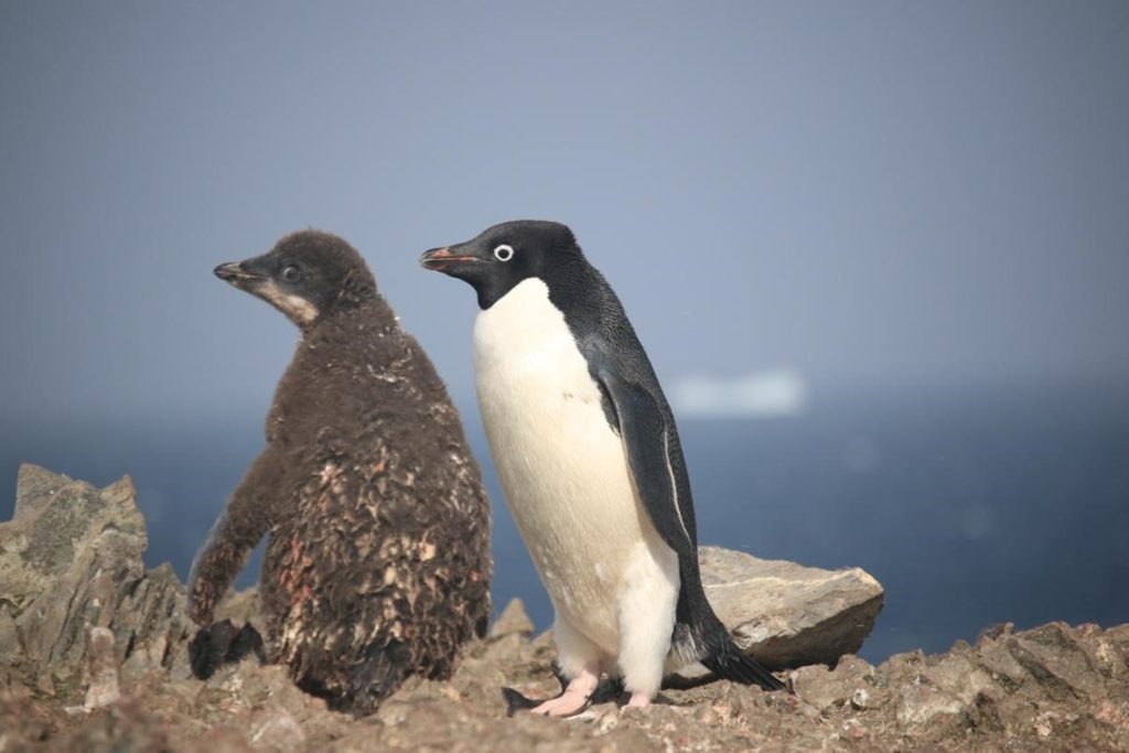
A key mission of the Antarctic Ecosystem Research Division (AERD) at NOAA Fisheries’ Southwest Fisheries Science Center (SWFSC) is to develop an understanding of how an international krill fishery operating in Antarctic waters may impact other Antarctic wildlife that consume the main target of this fishery: Antarctic krill (Euphausia superba). Three species of brush-tailed penguins (Pygocelis spp.) nesting in the South Shetland Islands off the Antarctic Peninsula primarily or exclusively consume Antarctic krill. Over the last three decades AERD scientists have monitored the number of penguin chicks raised each year by Adelie (Pygocelis adeliae), Gentoo (Pygocelis papua), and Chinstrap (Pygocelis antarcticus) penguin as one important indicator of how these populations are responding to natural variability and to the impacts of the krill fishery.


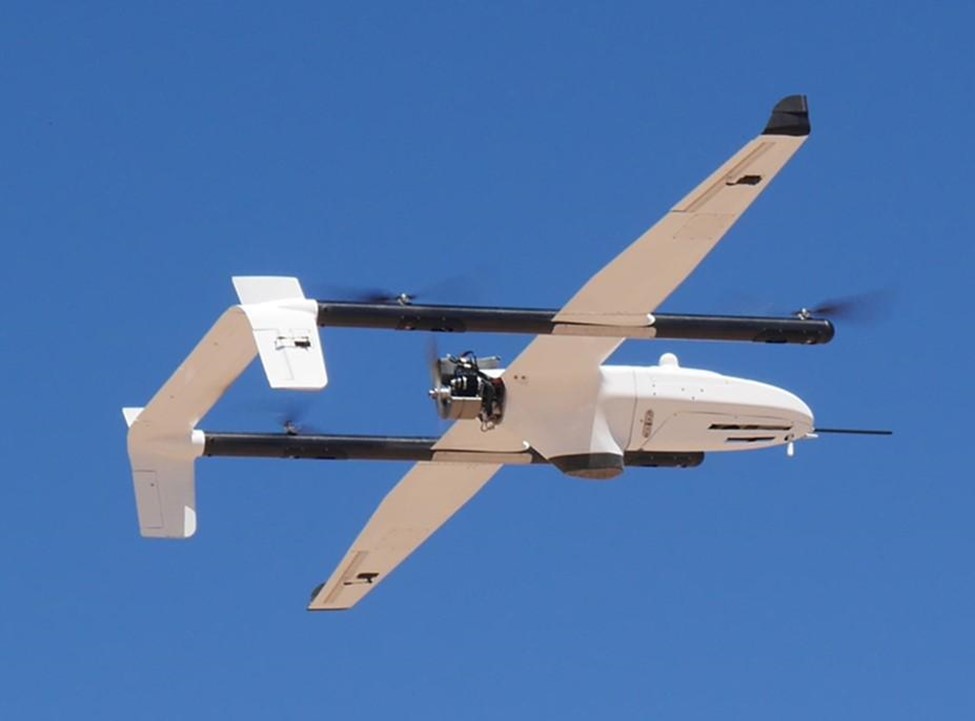
During this project Dr. Trevor Joyce, a contractor affiliated with the SWFSC’s Marine Mammal and Turtle Division, and Dr. Jefferson Hinke from AERD flew a series of Uncrewed Aerial Systems (UAS) missions at AERD’s Copacabana Field Camp on King George Island, Antarctica (62.178°S, 58.446°W) using the FireFly6 Pro fixed-wing vertical take-off and landing (VTOL) UAS. The purpose of these flights was to collect very high-resolution aerial images (0.7-1.2 cm ground sampling resolution) of the penguin colonies in order to count the number of penguin chicks produced in the current breeding season.

First Beyond Visual Line of Sight (BVLOS) UAS Mission to Map and Count Penguins in Antarctica Read More »

NOAA and Duke University Examine UAS-based Approaches for Coastal Wetland Monitoring

Project team: NOAA National Centers for Coastal Ocean Science (NCCOS), Duke University Marine Robotics Laboratory and Remote Sensing Laboratory, North Carolina National Estuarine Research Reserve (NERR) and North Inlet-Winyah Bay NERR.

The core mission of NOAA’s National Ocean Service (NOS) includes stewardship of sensitive coastal habitats like those of the National Estuarine Research Reserve System (NERRS), a collection of 29 sites nationwide where NOS and States partner to promote research, education, and preservation of estuarine ecosystems. Unmanned Aerial Systems (UAS) can improve tidal wetland monitoring by providing high spatial resolution and coverage, with customizable sensors, at user-defined times.

This NOS National Centers for Coastal Ocean Science (NCCOS) research project, supported by the NOAA Uncrewed Systems Research Transition Office (UxSRTO), develops methods for the incorporation of Uncrewed Aircraft Systems (UAS) to expand routine wetland monitoring programs like those conducted by the National Estuarine Research Reserve System (NERRS).

NOAA and Duke University Examine UAS-based Approaches for Coastal Wetland Monitoring Read More »

Schematic of proposed Concept of Operations (CONOPS) plan in unrestricted airspace for operational High-altitude Operational Return Unmanned System (HORUS) flights. Photo Credit: Sydnee Macias|GML.

NOAA GML Scientists Successfully Test the “High-Altitude Operational Returning Uncrewed System” Glider with AirCore Science Package to 75,000 feet MSL

Recent flight testing of the “High-altitude Operational Returning Uncrewed System” (HORUS) at NASA’s Armstrong Flight Research Center and Edwards Air Force Base, California between May 13-25, 2021 marks a huge success within NOAA. Scientists from NOAA’s Global Monitoring Laboratory (GML) and Cooperative Institute for Research in Environmental Sciences (CIRES) tested the ability to launch and recover the uncrewed HORUS glider and its AirCore science payload with operations up to 75,000 ft above mean sea level (MSL). The reusable platform and AirCore instrument ascended into the upper atmosphere, attached to a balloon before being released. It then collected air samples vertically from 72,000 ft MSL down to a predetermined landing spot during its remotely controlled, designed, spiraling descent. Reaching speeds of more than 200 knots at the beginning of the glide phase, HORUS was able to make up for the downwind drift caused by the 60+ knot wind speeds it had encountered around 40,000 feet MSL during its earlier balloon ascent. The successful testing brings the NOAA/OMAO Uncrewed Systems Operation Center (UxSOC) funded; and NOAA/OAR Uncrewed Systems Research Transition Office (UxSRTO) supported HORUS development to a Readiness Level of 8. This marks an exciting opportunity for many other NOAA atmospheric research stakeholders because HORUS enables the deployment and retrieval of high-value, balloon-borne packages from a designated launch and recovery location, even when strong mid-level wind conditions can be expected.  With the HORUS, scientists can much more efficiently collect critical, higher-accuracy atmospheric measurements from all over the world to help improve weather and climate models, which have been limited until now because of the inability to effectively retrieve and reuse valuable sensor packages in areas where conditions and a lack of such technology have prohibited the realization of this novel concept.

NOAA GML Scientists Successfully Test the “High-Altitude Operational Returning Uncrewed System” Glider with AirCore Science Package to 75,000 feet MSL Read More »

NOAA PSL and L3Harris Complete miniFlux Payload Integration and Flight Tests

With funding and logistical support from the NOAA Oceanic and Atmospheric Research (OAR) Uncrewed Systems Research Transition Office (UxSRTO), in addition to the NOAA Pacific Marine Environmental Laboratory (PMEL) Clear and Cloudy Sky payloads, the NOAA OAR Physical Sciences Laboratory (PSL), together with partners at the Cooperative Institute for Research in Environmental Sciences (CIRES) and Integrated Remote and In Situ Sensing (IRISS) program at the University of Colorado Boulder developed the miniFlux sensor suite for operation on the L3Harris Latitude Fixed Wing Vertical Takeoff and Landing (VTOL) Rotator (FVR-55).  miniFlux is a collection of complementary systems and sensors selected to provide robust and accurate measurements of atmospheric thermodynamic and kinematic states. miniFlux carries sensors to make redundant measurements of temperature, humidity, and pressure, in addition to nadir and zenith thermal IR temperatures and sensors to provide a three dimensional wind measurement. In combination, these measurements, combined with accurate inertial position and orientation measurements collected by the miniFlux system, enable for estimation of atmospheric energy transfer conditions.

On May 6, 2021 L3Harris and PSL successfully completed payload integration and flight testing at the Florence, AZ test flight area. The miniFlux was mounted on the wing of the FVR-55.

Final engineering checkout is planned with L3Harris Latitude FVR-55 and NOAA PMEL and PSL payloads on the Commercial 96' vessel TowBoatU.S. Richard L. Becker, this summer.  NOAA staff from UxSRTO, OMAO UxSOC, PMEL, and PSL will be on the boat as well as the UAS team from L3Harris.

NOAA PSL and L3Harris Complete miniFlux Payload Integration and Flight Tests Read More »

NOAA PMEL and L3Harris Complete Cloudy Sky and Clear Sky Payload Integration and Flight Tests

As a continuation of the research, the NOAA Oceanic and Atmospheric Research (OAR) UxS Research Transition Office awarded L3Harris a Phase III follow-on contract for the continued development of the FVR-55. This contract is to support shipboard operations and scientific payload integration on the FVR-55. Flight tests were completed on February 17, 2020 off the M/V Richard L. Becker out of Fort Lauderdale, FL to demonstrate autonomous takeoff and recovery from a moving vessel at-sea.  L3Harris completed all objectives and demonstrated fully autonomous flight using Hybrid Quadrotor (HQ) technology from a moving ship with limited deck space.

On March 22-26, 2021 the NOAA PMEL team joined the L3Harris staff at their facility in Tucson, AZ to complete bench and initial flight testing (Florence, AZ test flight area) of the Cloudy and Clear Sky payloads to verify the payloads functionality. The two payloads measure the aerosol and cloud properties required for the observation of aerosol direct radiative effects (Clear Sky payload) and impacts of aerosols on clouds (Cloudy Sky Payload).

NOAA PMEL and L3Harris Complete Cloudy Sky and Clear Sky Payload Integration and Flight Tests Read More »