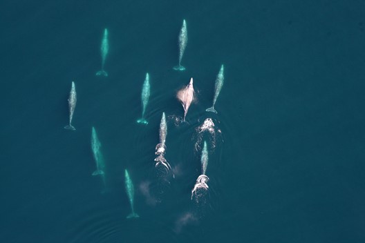
Marine Mammal Monitoring Surveys Using a Hybrid Fixed-Wing UAS
Gathering data on the size of marine wildlife populations and better understanding the risks human activities pose to these populations are core responsibilities of NOAA Southwest Fisheries Science Center / Marine Mammal and Turtle Division. In this study, supported by the UAS Program Office, scientists will be evaluating the use of a fixed-wing UAS platform with vertical take-off and landing (VTOL; Firefly6 Pro, BirdsEyeView Aerobotics, Inc.).
Marine Mammal Monitoring Surveys Using a Hybrid Fixed-Wing UAS Read More »